
Walk a Washington County Street
A good Washington County street directory search moves from the most stable clue to the least stable one. The physical parcel comes first. A street label can change, a postal city can mislead, and a tax bill may go elsewhere. The parcel number and legal description tie the map to the recorded land. From there, deeds establish owners while voter material and reverse directories add narrower evidence about people connected to the address.
- Enter the situs address in the Washington County DataScout property search. Save the parcel number, owner name, mailing address, and legal description shown on the parcel card.
- Open the county Public Webmap and click the parcel polygon. Pan along the named street and inspect each adjoining parcel rather than treating one map label as a full household.
- Use the owner and legal description in the current Circuit Clerk land index. Record the deed parties, document or book-page reference, and recording date.
- Use VoterView only to verify an individual with legitimate identifying details. A street list requires the separate Secretary of State voter-file request process and remains subject to protected-address rules.
- For an earlier household, ask the Grace Keith Genealogy Collection or Arkansas State Archives for an address-arranged city or telephone directory.
The sequence prevents a common error: treating ownership as occupancy. It also supplies a fallback at each point. If the portal fails, the Assessor and Circuit Clerk counters remain available; if an old address is hard to place, the Archives and library can work from plats, directories, and deed books.
Keep a simple worksheet for every stop. Copy the address as displayed, parcel number, legal description, source date, indexed name, and any book-page or instrument reference. Washington County's rapid growth makes the date vital. A later parcel card can differ from the deed that first tied a person to the land, while a directory may reflect a publication cutoff months before its cover year.
The offices divide work by record, not by the searcher's goal. The Assessor maintains valuation and parcel identity. The Circuit Clerk records land instruments and keeps circuit files. The County Clerk handles registration, marriage licensing, DBAs, county court, and probate functions. Knowing that split saves calls and prevents a request for deed images from being sent to the clerk who maintains voter registration.
Search Washington County Parcels
The county-designated DataScout property search is the practical address gateway. Its core modes accept owner name, property address, parcel number, and subdivision. A partial surname or street may help, but the live vendor interface can change. Confirm field behavior before relying on a broad result set.
| Search control | Input | Required | Street-search use |
|---|---|---|---|
| Owner Name | Text | No | Find parcels tied to a known owner; try a surname or partial form |
| Property Address | Text | No | Search the situs number and street name |
| Parcel Number | Text | No | Return to the exact county parcel without spelling ambiguity |
| Subdivision | Text or dropdown | No | Narrow lots where the vendor makes the control available |
| Search / Clear | Buttons | Not applicable | Run or reset the query |
See the actual entry point in the Washington County property-search interface.
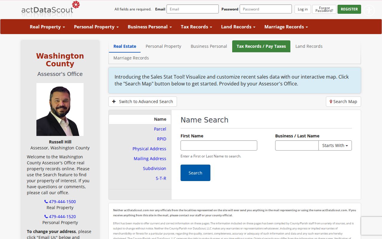
The screen is the start of a by-address search, not the end. A parcel card can show record ownership and separate mailing and situs addresses, but it cannot list every person in a household.
A parcel result may also display land value, building value, total assessed or market values, subdivision or acreage detail, and property characteristics where the vendor publishes them. Those fields help distinguish two similar street results. A homestead indicator can support an owner-occupancy theory, but it does not identify each resident, and its absence does not establish that the site is vacant or leased.
When the live result is unclear, the Assessor is at 280 N. College Avenue, Suite 250, Fayetteville, and can be reached at 479-444-1500. Office hours in the research are Monday through Friday, 7:30 a.m. to 4:30 p.m. Ask which value year or roll date applies, since real estate is reappraised every four years and new construction is added each year.
Read Washington County Address Clues
Several terms keep a street directory search tied to the right land. They matter most in rural Washington County, where E911 conversion, annexation, or a changed delivery label can break a plain street-name search.
- Parcel
- A mapped unit of land with a county identifier. One parcel may contain one home, several units, or no residence.
- Situs address
- The physical location used by the assessor and GIS. It is not the same as the owner's tax-mail address.
- Plat
- A recorded plan that sets out lots, blocks, streets, and subdivision boundaries.
- Criss-cross directory
- An address-arranged directory used to look up a listed subscriber or householder by street instead of surname.
Use the legal description when a street name no longer matches. Lot, block, subdivision, acreage, or metes-and-bounds wording can remain stable while a rural route becomes a numbered road.
Parcel numbers are county identifiers rather than coded postal addresses. Plats can show how a large tract became smaller lots, which explains why an early deed covers more land than one present parcel. In rural parts of the county, a metes-and-bounds description follows measured directions and landmarks instead of a platted lot. Copy it precisely, since one changed call can point to different land.
Note: Washington County research found no official countywide street-renumbering chronology, so deeds, plats, maps, and directory evidence must carry the address bridge.
Browse Washington County Street Parcels
The Washington County GIS gateway links the Public Webmap and DataScout Map. Search the target address, zoom to the parcel, click its polygon, then pan and click each adjacent polygon. Layers may add planning, zoning, flood, or jurisdiction context. They help explain which clerk holds a permit file and whether a postal city label matches municipal limits.
The map is not a survey. Parcel and street data drawn over aerial images use the best material available, and the county's planning disclaimer rejects survey-level reliance. A multifamily parcel also needs special care because one owner label can sit over many homes.
Map the street one polygon at a time. A curb, creek, highway, campus tract, or large rural parcel may interrupt what looks like a neat row of neighbors. The layer list can help identify flood or planning context, but available controls may change in the JavaScript viewer. No export or street-sort function was verified in the research, so do not promise one.
The Arkansas GIS maps catalog supplies statewide address and map context.
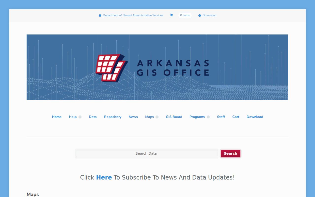
This statewide view complements the county parcel map. It is useful when an address lies near a municipal or county edge, yet the county parcel card and recorded instrument remain the evidence to cite.
Washington County Street Records
A Washington County street directory becomes more reliable when each source answers only its own question. The assessor identifies the record owner. GIS shows the spatial parcel. Deeds document transfers. Voter data covers registered voters under its access rules, while planning files identify an applicant or project rather than a household.
| Address source | Custodian | Evidence supplied | Ways to reach it |
|---|---|---|---|
| Parcel card | Washington County Assessor | Owner, parcel, situs, tax-mail address, values, legal description | DataScout, courthouse counter, or phone |
| GIS parcel map | Washington County GIS | Parcel shape, adjacency, boundaries, and selected layers | Public Webmap or DataScout Map |
| Deeds, liens, and plats | Washington County Circuit Clerk and Archives | Parties, transfer instruments, book-page references, and land identity | Current index, Chronicle 1834-1991, counter, original indexes |
| Voter material | County Clerk and Arkansas Secretary of State | Individual status or released voter-file fields, not every occupant | VoterView, clerk counter, or written file request |
| Planning files | Municipality or Washington County Planning | Applicant, parcel, work, legal description, and approval dates | Portal, office, phone, or Arkansas FOIA request |
For material that is not online, call the named custodian about index practice, visit the public counter, or submit the county's General FOI request for an existing administrative record. The request should name the office, address, record type, date range, and desired format.
Arkansas FOIA asks for records rather than answers to questions. Immediate access is the baseline for an available, open record; if it is in use or storage, the custodian can certify that status and set a time within three working days. Reasonable actual reproduction charges may apply. The law does not override a sealed court file, protected voter address, restricted vital record, or another confidentiality rule.
For land copies, the Circuit Clerk counter is also distinct from a general FOI request. Ask for the instrument by document number or book and page, say whether certification is required, and verify the current statutory fee. Historical work may go to Archives instead. Fayetteville Public Library and FamilySearch affiliate tools can add research copies, but neither issues a county-certified deed.
Follow Washington County Deed Streets
Street names are weak keys in old land records. Start with the modern parcel card, then carry its legal description into the Circuit Clerk index. The purchase deed gives a grantor, the seller, and grantee, the buyer. Search the seller as an earlier grantee and compare the legal description at each hop. This is the chain of title.
At the historical boundary, switch to the free Archives Chronicle land index. It spans 1834 through 1991 and accepts grantor or grantee names, full search text, document type, book, and page range. Linked scans may be available. When a transcription seems wrong, Archives preserves the original handwritten index and accepts corrections.
The street directory uses this deed trail to confirm owners over time. It does not prove where a seller moved next, even if another deed later contains the same name.
Chronicle search results may expose party names, document type, sorting, book, page, and scanned material. Try surname variants and initials. Women may appear under maiden or married names, and entity ownership can hide a person. When two people share an Ozark family name, match legal description, date, spouse, and related parties before joining the records.
Current deeds remain in the separate Circuit Clerk/vendor route. The exact start of that live index was not established in the research. Do not invent a seamless online range. Use 1991 as the documented Chronicle boundary, then ask the Circuit Clerk how to retrieve the later instrument and Archives how to inspect the earlier original.
The Archives' broader holdings can extend the street chain when land indexes are not enough. Its guides cover administrative and financial material, court records, licenses and registrations, schools, tax and assessment books, communities, cemeteries, post offices, school districts, and a 1908 plat book. Search by the durable land clue first, then use a known person, school, or community name to test these less obvious groups.
Compare Washington County Voter Access
Arkansas offers two very different voter channels. VoterView verifies one voter through name and birth date and may return status, polling place, districts, and a sample ballot. It cannot browse all people along a street.
| Channel | Designed for | Address reach |
|---|---|---|
| VoterView | One voter's registration check | Individual result using identifying inputs |
| Secretary of State VR file | Requested statewide registration data | Released residential and mailing fields may support lawful filtering |
| County Clerk | Registration, correction, and procedure | Counter and phone help, subject to election law |
The bulk VR product is a separate request, not an expanded VoterView screen. It covers registered voters only. Secure-voter addresses and restricted fields stay protected, and a non-match never proves that no one lives at an address.
The Secretary of State documents VR registration, VH vote history, and a combined file. The history product records participation in federal elections from 2008 onward but never reveals a ballot choice. Large statewide files may exceed ordinary spreadsheet limits. Request terms, released fields, and statutory restrictions govern any local filtering, and protected addresses must never be reconstructed or shared.
The Washington County Clerk maintains registration at 280 N. College Avenue, Suite 300, Fayetteville, telephone 479-444-1711. That office is the correction and procedure channel. Treat active or inactive status as an election-administration fact, not a conclusion about current residence.
Route Washington County Address Files
A Fayetteville postal label does not prove that land lies inside Fayetteville. Springdale also spans Washington and Benton counties. Check parcel jurisdiction before choosing the permit custodian. Incorporated parcels go to the relevant city's planning or building office. Unincorporated land goes to Washington County Planning.
County Planning handles E911 address review, certified surveys and plats, floodplain matters, lot splits or combinations, subdivisions, conditional uses, and large projects in its territory. Its files may name an owner, applicant, parcel, acreage, legal description, zoning, survey, or project narrative. An applicant can be an agent or contractor, so do not silently relabel that person as a resident.
Washington County Planning is at 2615 S. Brink Drive in Fayetteville, telephone 479-444-1724, and is open Monday through Friday from 8:00 a.m. to 4:30 p.m. Online material, office contact, and an Arkansas Freedom of Information Act request form the full access chain.
Municipal files can include council agendas, board appointments, code matters, planning applications, and permits. Search the relevant city site or ask its records custodian after the parcel's municipal status is confirmed. For an address outside city limits, County Planning reviews matters such as occupancy certificates on request, plats, E911 addressing, towers, floodplain permits, subdivisions, conditional uses, and large-scale development.
Washington County Address Points Change
On May 2, 2024, the Arkansas GIS Office included Washington County among counties receiving updated situs address points. These data support address location and map services, but they remain a current layer rather than a history of who occupied each site.
The state address-point update shows the modern side of street research.
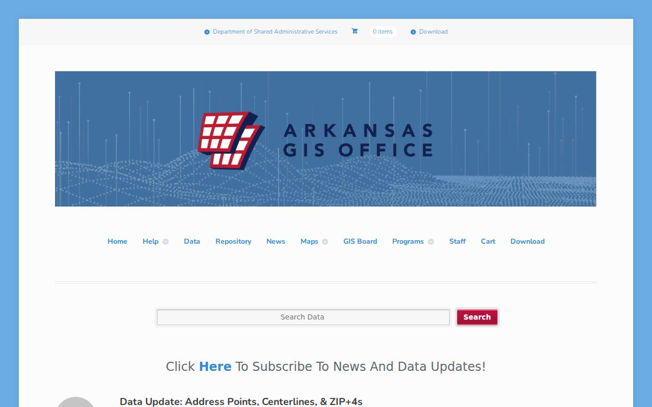
Pair the current point with a parcel number and legal description. That bridge survives changes in delivery labels better than the address text alone.
The same principle applies at county edges. A Springdale address can fall in Washington or Benton County, and a Fayetteville delivery label can extend beyond Fayetteville city limits. The USPS label routes mail; it does not select the land-record, permit, or tax custodian. First locate the parcel in county GIS, then confirm the city boundary and use the responsible office.
For rural addresses, Washington County Planning reviews E911 address applications in unincorporated territory. Municipalities maintain addresses inside their own limits. If an old record uses a rural route, carry the parcel and deed description forward instead of assuming that a present road number was used in the earlier instrument.
Note: Updated map data can locate a parcel, but it does not certify a boundary, a household, or a person's present residence.
Read Past Washington County Streets
Address-arranged city and telephone directories can supply names that deeds omit, especially subscribers and listed householders. The Fayetteville Public Library catalog documents a regional Northwest Arkansas telephone directory covering Fayetteville, Springdale, Farmington, Prairie Grove, Lincoln, Elkins, West Fork, Greenland, Johnson, Tontitown, Goshen, Elm Springs, and rural communities.
That wide reach is a useful quirk. A postal label could change or a person could cross a county edge without a long move. Ask the Grace Keith desk for the exact title, year, publisher, and whether the volume includes an address or criss-cross section. Its remote research service is a fallback when travel is not practical, sometimes with a cost.
Grace Keith also holds local newspapers, yearbooks, plats, maps, cemetery records, early marriage and probate material, and vertical files for people, buildings, and places. A street search can use a newspaper notice between directory years or a vertical file when an address was known by an older informal name. Licensed databases have varied access: some are in-library only, while affiliate access can open restricted digitized collections.
The Arkansas State Archives adds statewide city and business directories spanning 1840 through 1999, the 1865 Washington County census, school annuals, newspapers, and county microfilm. Contacting the reference desk is important because no authoritative online list identified every Fayetteville directory volume or publisher. A gap in the web catalog must remain a gap until staff verify the item.
The collections themselves belong to the Washington County city directory topic. Here they serve one narrow purpose: testing which listed names appeared at a specific street number in a specific edition.
Washington County Street Directory Limits
No Washington County street directory source provides a complete household roll. Parcel and deed records can omit renters and other occupants. Voter data omits children, nonregistrants, and protected people. A telephone directory lists subscribers, not all adults. Utility, delivery, and motor-vehicle address data are not a public street browser.
Commercial people-finder products may combine stale or mismatched material. Official custodian records are better for checking a specific fact, yet even they must be read within scope. Record dates matter in fast-growing Northwest Arkansas, where ownership, address points, and jurisdiction can change.
Arkansas law also creates deliberate absences. Secure-voter address information for qualifying domestic-violence victims is confidential. Sealed court cases, protected victim data, juvenile material, and restricted vital records follow separate rules. Never treat a missing public address as proof that a person is unregistered, unknown, or no longer connected with the county.
Correct a wrong item with the custodian that created or keeps it. Parcel ownership concerns go to the Assessor and recorded source, voter details to the County Clerk, and an index or deed-image issue to the Circuit Clerk or Archives. A portal usually mirrors official data and cannot settle an identity dispute by itself.
Lawful use. Washington County address records support family, property, and civic research. Never use them to stalk, harass, intimidate, or expose a protected person.
A careful conclusion stays modest: the named source connected a person, owner, or applicant to a parcel at a recorded time. Current occupancy needs separate, lawful proof.
Washington County includes urban apartments, university-area streets, fast-growing subdivisions, small Ozark towns, and rural acreages. Each setting changes the best evidence. Apartments often reduce the assessor result to an entity-owned tract. New subdivisions depend on current plats and GIS. Historic Fayetteville blocks gain from directories and maps, while a rural chain relies more on deeds, E911 addressing, and metes-and-bounds descriptions.
Use source dates openly. A current roll, an older deed, and a printed directory can all be accurate for different moments. If the aim changes from a whole street to one named person, use the resident lookup method rather than forcing a block record to answer an identity question.